







USA Weather Radar: How to Track Live Severe Storms & Local Forecasts
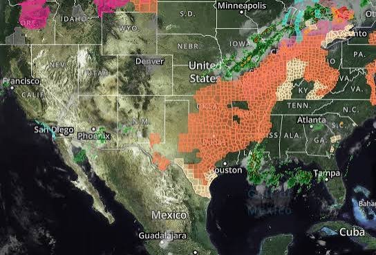
Checking the USA weather radar and local forecasts is critical for managing daily travel, flight departures, and outdoor plans. Weather conditions across the United States change rapidly due to jet stream shifts, coastal moisture, and seasonal severe weather events like tornadoes, hurricanes, and winter blizzards.
In this guide, we cover how to read live Doppler radar maps, track severe storm warnings, and utilize official US meteorological tools for hyper-local forecasts.
Essential US Weather Metrics to Monitor
National weather updates provide key meteorological data points designed to help residents prepare for sudden atmospheric changes:
| Weather Element | Measurement Standard | Practical Significance |
|---|---|---|
| Temperature (°F) | Fahrenheit air temp and Heat Index / Wind Chill. | Determines extreme heat warnings or frostbite risks. |
| Probability of Precipitation (%) | PoP percentage across specific zip codes. | Calculates exact likelihood of localized rain or snow. |
| Wind Gusts (mph) | Sustained speed and peak gust velocity. | Indicates dangerous travel conditions for high-profile vehicles. |
| Dew Point (°F) | Atmospheric moisture saturation point. | High dew points signal extreme humidity and severe storm potential. |
| Barometric Pressure (inHg) | Inches of mercury pressure trends. | Rapid drops indicate approaching low-pressure storm systems. |
| Air Quality Index (AQI) | 0 to 500 pollution and particulate scale. | Warns against outdoor activity during wildfire smoke or high ozone days. |
Regional Weather Systems Across America
Because the US spans multiple climate zones, seasonal weather threats vary significantly depending on geography:
-
- The Midwest & Plains (Tornado Alley): Spring and summer bring severe convective thunderstorms, destructive hail, and high-risk tornado watches.
- The Gulf & Atlantic Coasts: Hurricane season runs from June 1 through November 30, bringing severe coastal flooding and tropical storm surges.
- The Northeast & Great Lakes: Late autumn through winter sees heavy lake-effect snow, freezing rain, and high-impact Nor’easters.
- The West Coast & Pacific Northwest: Atmospheric rivers bring heavy coastal rainfall and winter mountain snow, while dry offshore winds increase wildfire risks in drier months.
Official USA Weather Radar & Alert Sources
To get accurate real-time weather alerts without delays, rely on official government platforms and active radar networks:
-
- National Weather Service (NWS): The official US government agency providing localized weather watches, warnings, and emergency broadcasts at weather.gov.
- NOAA Weather Radio (NWR): A nationwide network of radio stations broadcasting continuous weather information directly from nearby NWS offices.
- Emergency Alert System (EAS): Wireless Emergency Alerts (WEA) sent directly to mobile phones during flash floods, severe thunderstorms, and tornado emergencies.
Frequently Asked Questions (FAQs)
What is the difference between a Weather Watch and a Weather Warning?
A Watch means conditions are favorable for severe weather to develop in your area. A Warning means dangerous weather has been spotted on radar or visually confirmed, requiring immediate protective action.
What is the best app for live US weather radar?
RadarOmega, RadarScope, and the official NWS mobile portal provide raw, real-time Doppler radar feeds directly from NEXRAD stations across the country.
Final Takeaway
Monitoring the USA weather requires staying aware of regional climate shifts and checking official NWS alerts before major travel. Utilizing real-time Doppler radar apps and keeping emergency alerts active ensures you stay safe during severe weather events.